![]()
![]()
![]()
![]()
![]()
![]()
![]()
![]()


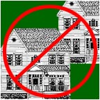
Protect the Partrick Wetlands
and our Community
![]()
|
THE SEWER IS SHOULD NOT BE EXTENDED
Presenter: Matthew Mandell
|
|
My name is Matthew Mandell and I am Director of the Partrick Wetlands Preservation Fund of Westport, a grass roots community organization. Sean Timmins co-director is aiding this presentation. Joining us is the Save Cranbury Association of Norwalk, and their co-directors, Joanne Jackson, Pete Hynes and Gail Wall.
We are here to support the concepts of smart growth, stopping sprawl, limiting new infrastructure and to let you know we have already embraced the idea of Regional Cooperation put forth in the Blue Ribbon Panel Report. We don't see a border between our communities and neither does over-development, traffic congestion or loss of open space.
In another sign of Regional Cooperation Senator Freedman along with Representatives Toni Boucher of Norwalk and Ken Bernhard of Westport also support our position in a letter published in all the local papers this week.
No longer can what I discuss tonight be called NIMBY, it is now NIMRA, not in my regional area. Or maybe it should just be called NIC, not in Connecticut.
If you leave this building and head north on rt 53 and bear right at Partrick avenue or Newtown Ave you will have entered the Sprawl Zone.
The sleepy neighborhood of Cranbury in Norwalk and quarter of a mile East up either road, the low density and rural neighborhood of Old Hill and Partrick in Westport. These neighborhoods are under attack from development and are a specific example of sprawl and a microcosm of what is occurring throughout Connecticut.
Sprawl, as the Report says, is not a universally understood concept. Some call it urbanization, others densification. I call it plain old Over-development, increased traffic, loss of open space and a negative change to the character of neighborhoods.
Near the intersection of Newtown and Partrick is where is begins.
A development called Cottenwood Chase a 5.4 acre property with a mix of wetlands that only recently had a single residence. It is now slated to have 5 clustered homes.
Two have been built so far only 25 feet apart and it is the example of what will be coming to other properties in the sprawl zone if over-development is not curtailed.
But how can this be the case? The answer is conservation or open space sub-divisions in conjunction with sewers. While clustering of houses can be a wonderful concept, it fails when developers take advantage of weak zoning regulations and actually create a greater impact than what would have occurred otherwise.
Sewers add to this impact by allowing closer clustering and a maximization of development of the property because no land is needed for septic fields. So sewers actually create an adverse effect by allowing more houses per acre of buildable land. And this besides allowing larger houses on the same property and the blight of what is called McMansions. Sewers create sprawl and over-development.
And here is where we get the real meat of the issue.
In Westport, the 56 acre Partrick Wetlands, located between Newtown Turnpike and Partrick Road is an environmentally sensitive land, a mix of wetlands, meadows and ponds. It has been purchased by developers and an open space cluster housing sub division proposal has been moving through the boards and commissions of the town. This wonderful ecosystem is the prime recharge area for the town's aquifer and is partially located above it as well. It is the home to a myriad of animals and is the last and largest piece of open space left in Westport.
Just a half mile closer in Norwalk and also between Newtown and Partrick Roads, is the famous Lucile Lortell White Barn Theater and Property. Since Ms. Lortell's death the Trustees of the property are seeking a developer to build cluster homes. This 18 acre property is also partly wetlands, home to its own ecosystem and is a prime piece of open space in Norwalk.
Let's look at the State Plan map
The Partrick Wetlands are a mix of Preservation (green) and Rural (white) land number 2 and 4 conservation priorities, the environmentally sensitive White Barn property is a mix of Neighborhood Conservation (pink), Conservation (light green) and Rural (white) lands, #2 development priority and #s 3 and 4 Conservation. If I might suggest, only because of the border between Norwalk and Westport is the White Barn not considered Rural. This should not be the case. As sprawl and traffic impacts cross the border, so should the rural distinction for this land as well. The Roads on either side and the communities surrounding it will be impacted as well. Also the Save Cranbury Association is formally requesting a review of the mapping of the White Barn as certain wetland areas are not apparent.
SEWER
In order to maximize the development of the Partrick Wetlands and indirectly aiding the full build out of the White Barn sub-division, the developer, ARS Partners, have proposed extending the Norwalk Sewer 1 mile in length and into Westport to allow their over-development of the Partrick Wetalands.
The result is an out of proportion and out of character impact in a proposal of 22 houses on nine buildable acres. 22 houses on nine acres.
The draft State Plan of Conservation and Development supports clustering, but only when the impact is no greater than traditional zoning would allow. In this case 5 - 9 houses depending on single or double acre zoning.
This excess will jeopardize the wetlands due to the houses close proximity, it will bring a greater loss of open space, increased traffic and a change in the local character of the neighborhood.
Development of the White Barn Property would also need sewers extended and the line running by it to Westport will allow its over-development as well. In all upwards of 45 houses could all be built in addition to Cottenwood and other properties just waiting to take advantage of the sewer.
Norwalks DPW sketched out how many properties could utilize the sewer. 435. Many of these will sub divide or build bigger houses exacerbating the already growing traffic problems of the area.
But the impact does not end there. The sewer will not stop at the wetlands. Once inside Westport, it will continue to be extended over the years, as the precedent for extending it will have been set. Developers will buy another piece of open space and pay to extend it further. The sewer will be our Hydra. This extension will bring sprawl, it will bring urbanization, it will bring traffic congestion, it eat up open space and it will change the rural New England character of this region forever.
The sewer will continue east on Newtown to Weston.
The sewer will head north on Rt 33 to Wilton.
And it will head south on 33 bringing with it everything the Blue Ribbon Report says we don't need.
The Sewer must be stopped.
The sewer extension is contrary to the State Plan, it is contrary to the Blue Ribbon Panel Report, it contrary to the Westport Town plan and it is contrary to the Norwalk Master Plan, and yet it moves forward.
The Norwalk Plan of Development says - "Limit the extension of the sanitary sewer system solely to areas where existing sanitary facilities are not viable." As of this week, there are no unusual amounts of septic failures in the Cranbury Area. Nor are there any on the Westport side. The sewer is solely to allow the developers ARS the ability to build 22 houses and to maximize their profit and our expense.
Let's look at Westport's Plan.
In 1987 Westport had ideas about bringing a sewer up to the property,
but in 1997 that changed as the focus of the plan was on protecting open space and the rural residential character of the area.
Again let's look at the State Plan's map so we know what we are looking at.
The concepts of smart growth, espoused throughout the State plan and the Blue Ribbon Panel report which essentially are tied together need to be applied here. This designated rural area needs to be protected. This can be your test case. It is an opportunity to achieve success right off the bat.
State Plan on Sewerage avoidance
"Avoid sewage collection systems except when essential to solve existing area-wide problems"There aren't any problems.
"Vigorously pursue sewer avoidance programs and limit development to those uses and densities that ensure indefinite functioning of on-lot or small community water supply and waste disposal systems"What it says here is don't extend a sewer but promote septic and what the State Plan also discusses as new technology on-site waste systems.
Blue Ribbon Panel Says
"The Commission recommends that the state's sewer planning process be consistent with the state's plan of conservation and development." p11.We know what that is, I just read it, avoid sewers.
The report continues with gathering information:
"This analysis would include evaluations of the equitable allocation of water resources and sewer-avoidance policies, based on impacts of future land use development patterns." p13But more importantly is thrust of the BRP report that of not extending infrastructure to further new development.
"encourage development where infrastructure already exists, and conversely away from where it doesn't and where development would harm environmentally sensitive and precious land."The Partrick Wetlands and the White Barn property meet both criteria, environmentally sensitive and precious open space.
The report finishes in no uncertain terms.
"sprawl means that development does not occur where the infrastructure to support it already exists but instead occurs .. where new .... sewers and other infrastructure must be built. The present system promotes disinvestments in our cities and urbanized towns. This adds to traffic woes, the loss of open space and disfigures the face of Connecticut."And the Report and State Plan make no distinction between publically or privately financed extension of infrastructure. The short term and long term impacts are the same. And the future carrying costs and future infrastructure needs will be solely bourne by the municipalities and in the end the tax payers.
Allow me to go back the State Plan.
"Focus on improvement of existing infrastructure to support redevelopment and infill, and discourage urban development in rural areas."As we can see from the map, the entire Partrick area is designated as rural. Allow me to stay with the rural aspect now
The State Plan says Don't promote encroachment on Rural areas
"Approve actions not consistent with long-term preservation only when it is demonstrated that there are overriding social, economic, and public benefits and there are no feasible alternatives."There is no public benefit to the such massive encroachment on a wetlands or a community. Over 2200 Westport residents signed a petition seeking the denial of this proposal. That's 10% of the population."Plans and proposals not consistent with the preservation values of an area should only be pursued when there is a lack of available alternative sites and there is an overriding public benefit".
"Investment in infrastructure has shaped community character. Public sewer and water systems and highway improvements support urban scale and densities that are not consistent with rural character.In a nut shell the sewer should not be extended and this rural area should be protected.
So why are we all here? There are a few reasons.
The first is to make you aware of the grave situation in our area. To inform a few more people and to have the press then tell more people.
The second is to seek your help.
We need your help so that private ventures don't manipulate and extend infrastructure that only serves their goals and in the end will create great harm.
You have a mandate to help us. Because on Page 95 of the State plan is says you'd "work with selected neighborhood groups, when possible." We'd like to work with you. We'd like you to take a specific interest in this situation and make it work out.
Mayor Knopp has set up a 5 member task force to review the need for sewer extension. And taking a page from the BR report he has asked the 7 members of the Westport Planning and Zoning commission to meet with Norwalk's Planning commission in conjunction with the Task Force to look at cross border impacts from development. We applaud this bold move and hope for a positive outcome. Hopefully this presentation helped out.
The third reason we are here is we'd like you to help th Mayor and Norwalk out even further. One of the main concepts of the BR Report, is that of incentives for municipalities be given to promote smart growth initiatives instead of dumb growth, which is what the sewer is. Norwalk has needs that should be addressed
[added] And Mayor Knopp in his address said you should focus on the cores of municipalities.
Roodner Court -- Fodor Farm -- West Ave.which is something the state already knows about and something you help with. -- Wall St. and the Reed Putnam project. These are all things that the state could support to promote smart growth in Norwalk's Core and thus fulfill the spirit and goals of the State Plan and the Blue Ribbon Report. And at the same time the sewer would not extend and the rural character of the rural outer ring would be maintained.
Now of course there are issues with the financing of all this. I attended the hearing on Monday and tax and spending issues swirled around. I am no economist and I don't have answers for you, But don't let any of this stop you from pushing through the land use aspects. Because while you debate and tinker with the financials developers will be buying up more open space and extending sewers and creating sprawl and destroying the character of Connecticut.
"Connecticut's land use model is at a point in its evolutionary process where changes must be made to minimize the costs generated under the current development format. The time for this required transformation is now."Heed your own report, don't waste time, follow through on the land use issues immediately.
In closing I'd like to read from page 98 of the State Plan
"To bring greater harmony and predictability between land use planning and infrastructure planning, consideration should be given to enabling the establishment of urban service boundaries'. An urban service boundary is an officially adopted and mapped line that divides the community into lands to be developed and lands to be protected, or where lower densities are maintained."The line between Norwalk and Westport does not stop sprawl or traffic, it does not stop the loss of open space or the loss of neighborhood character. It's time to draw a new line that protects all our communities.
We hope you act and we hope you help us so......
This .... won't become this.
This backyard does not become.... this
And this country store does not become .... this another 7 - 11.
I thank you for you time.